Hagatna (Agana)
 Guam
Guam
Key facts and a structured country profile. 🧾 Change log 📐 True Size
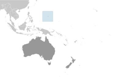
Locator 🗺️ Map
169,532 (2024 est.)
544 sq km
Oceania, island in the North Pacific Ocean, about three-quarters of the way from Hawaii to the Philippines
🧭 Background
Guam was settled by Austronesian people around 1500 B.C. These people became the indigenous Chamorro and were influenced by later migrations, including the Micronesians in the first millennium A.D., and island Southeast Asians around 900. Society was stratified, with higher classes living along the coast and lower classes living inland. Spanish explorer Ferdinand MAGELLAN was the first European to see Guam in 1521, and Spain claimed the island in 1565 because it served as a refueling stop for ships between Mexico and the Philippines. Spain formally colonized Guam in 1668. Spain’s brutal repression of the Chamorro, along with new diseases and intermittent warfare, reduced the indigenous population from more than 100,000 to less than 5,000 by the 1700s. Spain tried to repopulate the island by forcing people from nearby islands to settle on Guam and preventing them from escaping. Guam became a hub for whalers and traders in the western Pacific in the early 1800s. During the 1898 Spanish-American War, the US Navy occupied Guam and set up a military administration. The US Navy opposed local control of government despite repeated petitions from the Chamorro. Japan invaded Guam in 1941 and instituted a repressive regime. During the US recapture of Guam in 1944, the island’s two largest villages were destroyed. After World War II, political pressure from local Chamorro leaders led to Guam being established as an unincorporated organized US territory in 1950, with US citizenship granted to all Chamorro. In a referendum in 1982, more than 75% of voters chose closer relations with the US over independence, although no change in status was made because of disagreements on the future right of Chamorro self-determination. The US military holds about 29% of Guam’s land and stations several thousand troops on the island. The installations are some of the most strategically important US bases in the Pacific; they also constitute the island’s most important source of income and economic stability.
🗺️ Geography
Oceania, island in the North Pacific Ocean, about three-quarters of the way from Hawaii to the Philippines
13 28 N, 144 47 E
Oceania
544 sq km
544 sq km
0 sq km
Three times the size of Washington, D.C.
0 km
125.5 km
12 nm
200 nm
Tropical marine; generally warm and humid, moderated by northeast trade winds; dry season (January to June), rainy season (July to December); little seasonal temperature variation
Volcanic origin, surrounded by coral reefs; relatively flat coralline limestone plateau (source of most fresh water), with steep coastal cliffs and narrow coastal plains in north, low hills in center, mountains in south
Mount Lamlam 406 m
Pacific Ocean 0 m
Aquatic wildlife (supporting tourism), fishing (largely undeveloped)
29.6% (2023 est.)
Arable land: 1.9% (2023 est.)
Permanent crops: 13% (2023 est.)
Permanent pasture: 14.8% (2023 est.)
52.4% (2023 est.)
18% (2023 est.)
2 sq km (2012)
No large cities exist on the island; large villages (municipalities) attract much of the population; the largest of these is Dededo
Frequent squalls during rainy season; relatively rare but potentially destructive typhoons (June to December)
Largest and southernmost island in the Mariana Islands archipelago and the largest island in Micronesia; strategic location in western North Pacific Ocean
👥 People and Society⬆️ Top
169,532 (2024 est.)
87,345
82,187
Guamanian(s) (US citizens)
Guamanian
Native Hawaiian and other Pacific Islander 46.1% (Chamorro 32.8%, Chuukese 6.7%, Palauan 1.4%, Pohnpeian 1.4%, Yapese 1%, other Native Hawaiian and other Pacific Islander 2.8%), Asian 35.5% (Filipino 29.1%, Korean 2.2%, Japanese 1.4%, Chinese (except Taiwanese) 1.3%, other Asian 1.5%), White 6.8%, African descent or African-American 0.9%, Indigenous 0.1%, other 0.6%, mixed 10% (2020 est.)
English 43.3%, Filipino 24.9%, Chamorro 16%, other Pacific Island languages 9.4%, Asian languages 6.5% (2020 est.)
Christian (predominantly Roman Catholic) 94.2%, folk religions 1.5%, Buddhist 1.1%, other 1.6%, unaffiliated 1.7% (2020 est.)
26.4% (male 23,139/female 21,632)
62.7% (male 55,591/female 50,741)
10.9% (2024 est.) (male 8,615/female 9,814)
59.4 (2024 est.)
42.1 (2024 est.)
17.3 (2024 est.)
5.8 (2024 est.)
30.5 years (2025 est.)
29.6 years
31.1 years
0.08% (2025 est.)
17.9 births/1,000 population (2025 est.)
6.18 deaths/1,000 population (2025 est.)
-10.92 migrant(s)/1,000 population (2025 est.)
No large cities exist on the island; large villages (municipalities) attract much of the population; the largest of these is Dededo
95.2% of total population (2022)
0.84% annual rate of change (2020-25 est.)
147,000 HAGATNA (capital) (2018)
1.07 male(s)/female
1.07 male(s)/female
1.1 male(s)/female
0.88 male(s)/female
1.06 male(s)/female (2024 est.)
10.7 deaths/1,000 live births (2025 est.)
11 deaths/1,000 live births
10.9 deaths/1,000 live births
78 years (2024 est.)
75.6 years
80.5 years
2.7 children born/woman (2025 est.)
1.31 (2025 est.)
Total: 99.7% of population (2022 est.)
Total: 0.3% of population (2022 est.)
Total: 99.2% of population (2022 est.)
Total: 0.8% of population (2022 est.)
40.4% (2020 est.)
🌿 Environment⬆️ Top
Freshwater scarcity; reef damage; inadequate sewage treatment; rapid proliferation of the non-native brown tree snake
Tropical marine; generally warm and humid, moderated by northeast trade winds; dry season (January to June), rainy season (July to December); little seasonal temperature variation
29.6% (2023 est.)
Arable land: 1.9% (2023 est.)
Permanent crops: 13% (2023 est.)
Permanent pasture: 14.8% (2023 est.)
52.4% (2023 est.)
18% (2023 est.)
95.2% of total population (2022)
0.84% annual rate of change (2020-25 est.)
1.819 million metric tonnes of CO2 (2023 est.)
1.819 million metric tonnes of CO2 (2023 est.)
141,500 tons (2024 est.)
17.9% (2011 est.)
🏛️ Government⬆️ Top
None
Guam
None
Guahan
GU
The native Chamorro name for the island, Guahan (meaning "we have"), was changed to Guam in the 1898 Treaty of Paris, when Spain relinquished Guam, Cuba, Puerto Rico, and the Philippines to the US
Unincorporated organized territory of the US with local self-government; republican form of territorial government with separate executive, legislative, and judicial branches
Unincorporated, organized territory of the US, with policy relations between Guam and the Federal government under the jurisdiction of the Office of Insular Affairs, US Department of the Interior
Hagatna (Agana)
13 28 N, 144 44 E
UTC+10 (15 hours ahead of Washington, DC, during Standard Time)
The name Hagatna is derived from the Chamorro word haga, meaning "life's blood" and referring to the town's role as the center of government for the island
Common law modeled on US system; US federal laws apply
Effective 1 July 1950 (Guam Act of 1950 serves as a constitution)
See United States
18 years of age; universal
President Donald J. TRUMP (since 20 January 2025)
Governor Lourdes LEON GUERRERO (since 7 January 2019)
Cabinet appointed by the governor with the consent of the Legislature
President and vice president indirectly elected on the same ballot by an Electoral College of electors chosen from each state to serve a 4-year term (eligible for a second term); under the US Constitution, residents of unincorporated territories, such as Guam, do not vote in elections for US president and vice president, but they can vote in Democratic and Republican presidential primary elections; governor and lieutenant governor elected on the same ballot by absolute majority vote in 2 rounds, if needed, for a 4-year term (eligible for 2 consecutive terms)
Gubernatorial: 8 November 2022
2022: Lourdes LEON GUERRERO reelected governor; percent of vote - Lourdes LEON GUERRERO (Democratic Party) 55%, Felix CAMACHO (Republican Party) 44%; Josh TENORIO (Democratic Party) elected lieutenant governor 2018: Lourdes LEON GUERRERO elected governor; percent of vote - Lourdes LEON GUERRERO (Democratic Party) 50.7%, Ray TENORIO (Republican Party) 26.4%; Josh TENORIO (Democratic Party) elected lieutenant governor
Gubernatorial: 3 November 2026
Legislature of Guam (Liheslaturan Guahan)
Unicameral
15 (directly elected)
Plurality/majority
Full renewal
2 years
11/8/2022
Democratic Party (9); Republican Party (6)
40%
November 2024
Supreme Court of Guam (consists of 3 justices)
Justices appointed by the governor and confirmed by the Guam legislature; justices appointed for life but subject to retention election every 10 years
Superior Court of Guam (includes several divisions); US Federal District Court for the District of Guam (a US territorial court; appeals beyond this court are heard before the US Court of Appeals for the Ninth Circuit)
Democratic Party Republican Party
None (territory of the US)
None (territory of the US)
AOSIS (observer), IOC, PIF (observer), SPC, UPU
None (territory of the US)
Discovery Day (or Magellan Day), first Monday in March (1521)
Description: territorial flag is dark blue with a narrow red border on all four sides; centered is a red-bordered, pointed, vertical ellipse containing a beach scene, a proa (outrigger canoe with sail), and a palm tree; the word GUAM in red is centered in the ellipse; the proa is sailing in Agana Bay with the promontory of Puntan Dos Amantes in the background meaning: blue stands for the sea and red for the blood shed in the fight against oppression; the central emblem is shaped like a Chamorro sling stone (a weapon for defense or hunting)
Coconut tree
Deep blue, red
"The Star-Spangled Banner"
Francis Scott KEY/John Stafford SMITH
Official anthem, as a US territory; played before "Stand, Ye Guamanians"
💹 Economy⬆️ Top
Small Pacific island US territorial economy; upper income, tourism-based economy; hard-hit by COVID-19 disruptions; relaunched many industries via vaccination tourism; domestic economy relies on multiple military bases; environmentally fragile economy
5.1% (2022 est.)
2.1% (2021 est.)
-10.5% (2020 est.)
$35,600 (2016 est.)
$35,200 (2015 est.)
$34,400 (2014 est.)
$6.91 billion (2022 est.)
Fruits, copra, vegetables; eggs, pork, poultry, beef
National defense, tourism, construction, transshipment services, concrete products, printing and publishing, food processing, textiles
77,700 (2024 est.)
5.6% (2024 est.)
5.4% (2023 est.)
5.5% (2022 est.)
13.7% (2024 est.)
13.3% (2024 est.)
14.1% (2024 est.)
34.6% of household expenditures (2021 est.)
1.3% of household expenditures (2021 est.)
$1.24 billion (2016 est.)
$1.299 billion (2016 est.)
32.1% of GDP (2013)
$545 million (2022 est.)
$193 million (2021 est.)
$379 million (2020 est.)
Taiwan 42%, Hong Kong 12%, Philippines 11%, Italy 8%, Australia 6% (2023)
Scrap iron, scrap copper, trunks and cases (2023)
$4.421 billion (2022 est.)
$3.662 billion (2021 est.)
$3.388 billion (2020 est.)
Singapore 52%, Japan 15%, Malaysia 6%, Taiwan 4%, Greece 4% (2023)
Refined petroleum, cars, trunks and cases, gas turbines, flavored water (2023)
The US dollar is used
⚡ Energy⬆️ Top
100% (2022 est.)
525,000 kW (2023 est.)
1.715 billion kWh (2023 est.)
90.023 million kWh (2023 est.)
92.1% of total installed capacity (2023 est.)
7.8% of total installed capacity (2023 est.)
0.1% of total installed capacity (2023 est.)
11,000 bbl/day (2023 est.)
150.555 million Btu/person (2019 est.)
📡 Communications⬆️ Top
70,000 (2021 est.)
43 (2022 est.)
98,000 (2009 est.)
62 (2009 est.)
About a dozen TV channels, including digital; multi-channel cable TV services are available; roughly 20 radio stations
.gu
81% (2017 est.)
3,000 (2022 est.)
2 (2022 est.)
🚚 Transportation⬆️ Top
N
3 (2025)
2 (2025)
3 (2023)
Other 3
1 (2024)
0
1
0
0
1
Apra Harbor
🛡️ Military and Security⬆️ Top
Guam Police Department (GPD); Guam (US) National Guard
The US military maintains thousands of active-duty uniformed personnel and several bases and installations on the island
Source: Factbook JSON archive.