 Where Is Iran Located?
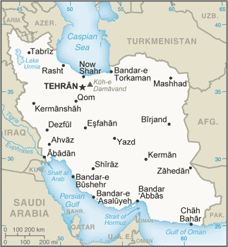
Use this map to see where Iran is located and jump to the full country profile.
What is the true size of Iran?
Most online maps use the Mercator projection, which can exaggerate land area away from the equator. Use the True Size tool to compare Iran at different latitudes and against other countries on the same projection.
Reported total area: 1,648,195 sq km. Population context: 89,177,357 (2025 est.). Geographic context: Middle East, bordering the Gulf of Oman, the Persian Gulf, and the Caspian Sea, between Iraq and Pakistan.